
Matthew is likely not a name you will want to hear for a long time. This was one of the most unusual storms that I have seen in all my years of tracking. It all began on September 25 when Invest 97 was born in the Atlantic. From that day forward, the models kept showing Matthew passing very close to the state of Florida. On September 28, Matthew became a named storm. On September 30, Matthew became a category 5 hurricane taking aim at Jamaica, Cuba and Haiti.
Archive for Tropic Watch 2016
Invest 99 Was The Storm That Couldn’t
Invest 99 was the little engine that couldn’t. From the first day that we started tracking it, it appeared to struggle for survival. That said, a good part of forecasting a tropical systems track is in the computer generated models. These models in the early stages of a system often create a windshield wiper effect where they keep bouncing back and forth between two points. usually, the final result is someplace in between all the runs. A lot of this information is obtained by NOAA planes risking their lives flying into the storms. The information from these planes is invaluable. Even with all the computer models, manual observations, satellites and radar, sometimes systems do what they want and when they want. In the case of 99L, since it was so weak the models had a rough time trying to find a starting point. The two main models the GFS and the Euro were battling it out to see who could win. In almost every run, our own GFS seems to have had the solution all along but it was discounted because nobody thought it made any sense. Most of the other models were saying we were going to get slammed. Forecasters are often put in a position of either alerting the public of a potential threat or saying everything is going to be fine. When the vast majority of models say everything is not going to be fine, you have to listen to the majority.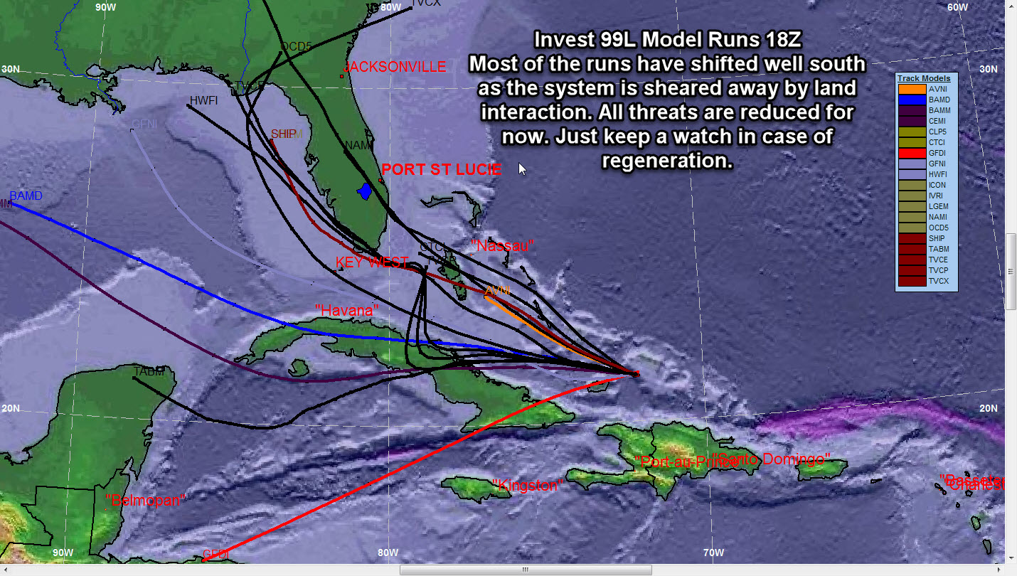
The 2004 Hurricane Nightmare Began 13 Years Ago Today
Good morning Treasure Coast!! 12 years ago today, the hurricane nightmare of 2004 began. First we had Hurricane Charley that came ashore the West Coast of Florida. That storm lasted from August 9-15. Then came Hurricane Frances that was born August 23 and lasted through September 6. Frances was not particularly strong but the system hovered over the Treasure Coast for hours pounding the area with sustained winds and flooding rain. Ivan was the next system to hit Florida and that system hit the Panhandle area with flooding rains and strong winds. Last but least is the infamous Hurricane Jeanne. Jeanne came ashore at almost the exact same place as Frances after doing a complete loop in the Atlantic. Jeanne lasted from September 13 through the 27th. Jeanne reinforced an already damaged Florida with even more damage. Because of these back to back hurricanes, most Treasure Coast homes now have newer roofs.
Category: Tropic Watch 2016 |
Tags: hurricane charley, hurricane frances, hurricane ivan, hurricane jeanne, hurricane season update
Hurricane Season 2016 Winding Up
Hurricane season 2016 is beginning to wind up and the parade of storms is starting to line up across the toasty Atlantic. It is so hard to ponder that it has been 11 years since we have a hurricane make landfall along the US East Coast. This is without doubt one of the longest hurricane draughts we have seen in recent history. The big question is if it will continue through 2016.
Category: Invest 96 and 97, Tropic Watch 2016 |
Tags: hurricane, invest 96, Invest 97, Tropical Storm
Heavy Rain Event for East Central Florida
Good morning Treasure Coast. WE have a lot going on so let’s get to it. Of course our main concern is what is happening in the tropics. A hurricane hunter is going out today to investigate the system that I expect will soon be Colin. The model trends have been more towards North Florida but these models will likely change when the system develops. Regardless of the track, the system will be large and will affect a large area with rain and potential severe weather.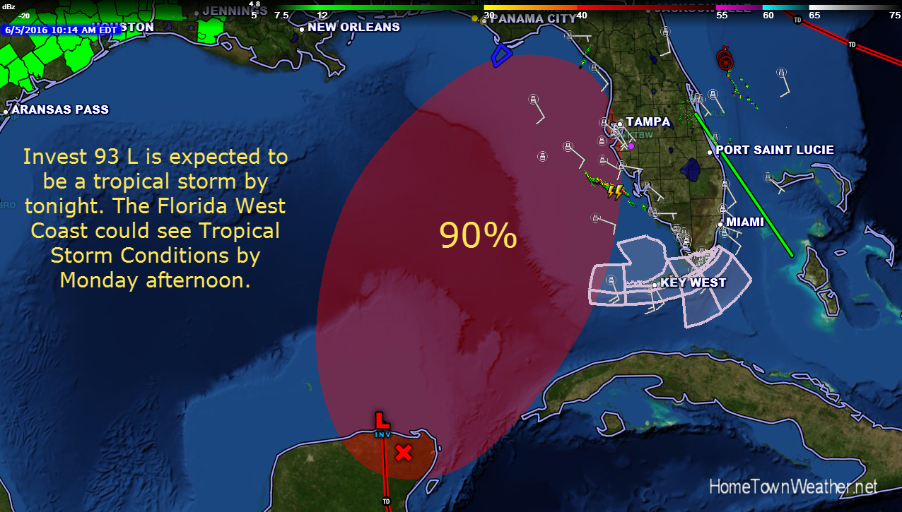
Potential Tropical Activity for Florida
Good evening everybody. We continue to closely monitor the potential development in the Gulf. System development is becoming more likely as time goes on. Regardless of system development, rain chances are going to increase significantly early next week in East Central Florida. Deep tropical moisture is going to bring increased rain chances to our region as well as most of Florida.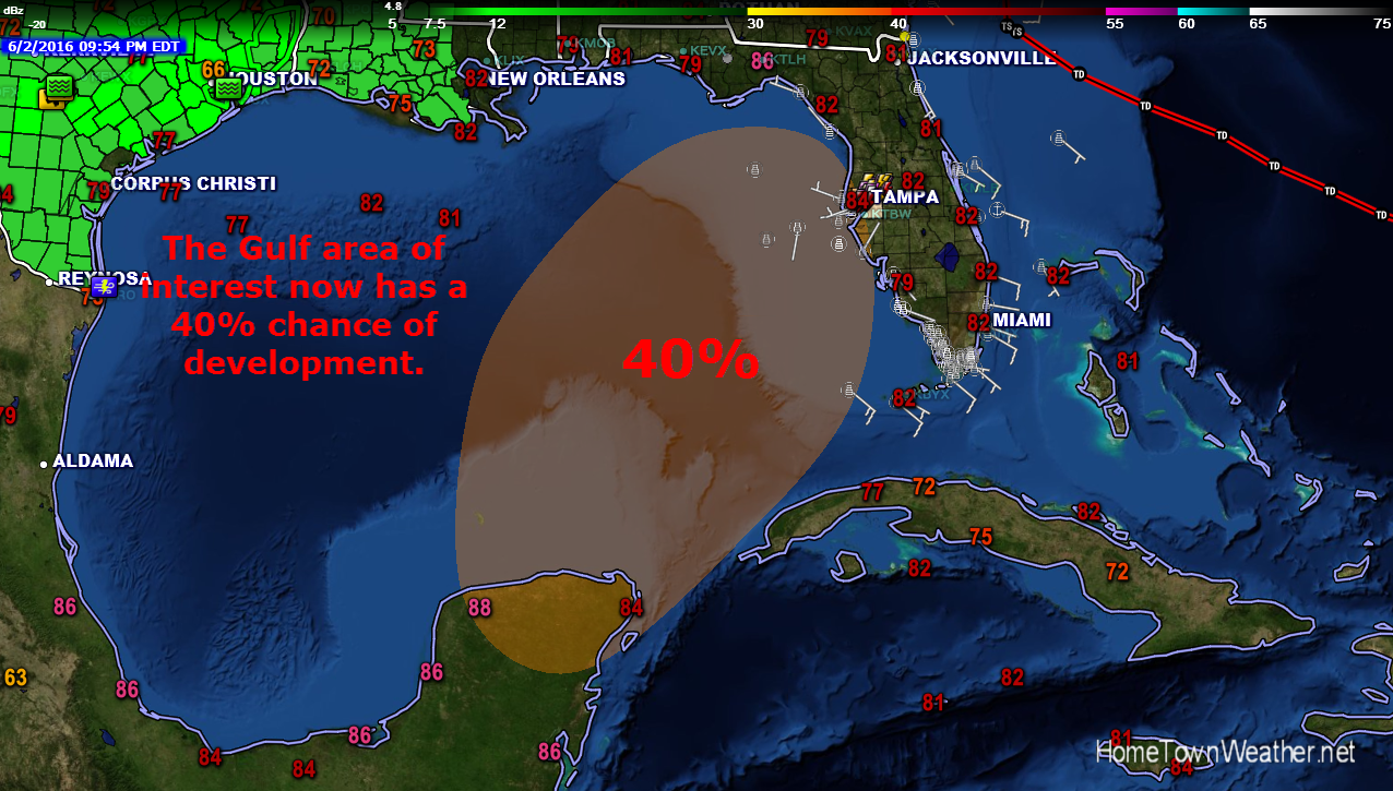
Hurricane Season 2016 Begins Today
Good Morning everybody and welcome to hurricane season 2016!! Today marks the first day of the Atlantic hurricane season. This year we area starting off the season with 2 storms already under our belt. In fact, some global models are showing the potential to a tropical entity early next week. I would not bank a whole lot on the hype since right now the Gulf of Mexico is completely clear and a forecast that far out is simply way too much speculation.
Hurricane Season Forecast Issued By Colorado State
The official hurricane season forecast is out from the Colorado State University. They are calling for an average season with 12 named storms. The new forecast is based on several factors including the presence of El Nino and ocean SST temperatures.
There has been a strong presence of El Nino during the past  several months. El Nino is now on a slow downward trend as we head for a potential La Nina, the opposite of El Nino. It will likely dissipate before the peak 2016 hurricane season. This trend will likely happen by August.
Category: Tropic Watch 2016 |
Tags: hurricane season forecast
Hurricane Season 2016 Predictions
Good afternoon everybody! The early predictions for the 2016 Hurricane Season are out but you should probably take them with a grain of salt this year. The years is projected to be about normal with 14 named storms, 8 hurricanes including 4 major hurricanes. These numbers could be raised or lowered when the actual season begins on June 1.
The reason? An area of cold water is slowly migrating towards the main hurricane breeding ground. If the ocean currents pick up this colder water, the season will fall below normal as one of the major ingredients for hurricane production will be stopped.
Category: Tropic Watch 2016 |
Tags: hurricane season 2016