Hurricane season 2016 is beginning to wind up and the parade of storms is starting to line up across the toasty Atlantic. It is so hard to ponder that it has been 11 years since we have a hurricane make landfall along the US East Coast. This is without doubt one of the longest hurricane draughts we have seen in recent history. The big question is if it will continue through 2016.
If you add up all the factors that are in place, the answer is quite simple but yet extremely complicated. So you wonder how can it be complicated and simply at the same time? Let me explain. As you most likely know, tropical systems need a host of conditions before anything can actually begin to form. You need warm ocean temperatures, and we have plenty of that to go around this season. You need low wind shear and that is already pretty much in place. You need moisture in multiple levels of the atmosphere and you need an actual cluster of thunderstorms. When all of the ingredients are in place, you will have the beginnings of the birth of a hurricane.
Right now, pretty much all the ingredients are there except there is some dry air from the SAL layer still present in the Atlantic Basin. This will likely help to suppress storms in the near term but later in August, we could be in for quite a ride. The SST (sea Surface Temperatures) are quite a bit above normal right now. That would give a system plenty of fuel if all the other above ingredients are met. With the absence of an En Nino’, the wind shear is likely to remain low in the Atlantic Basin.
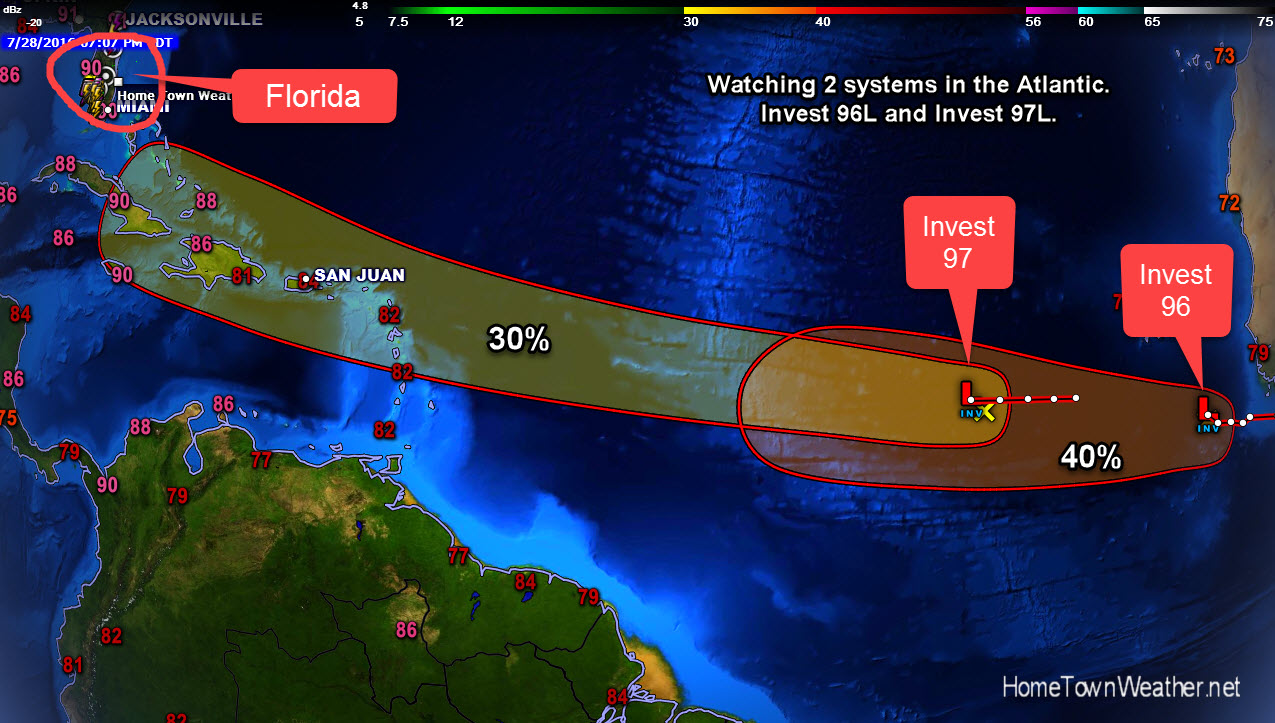
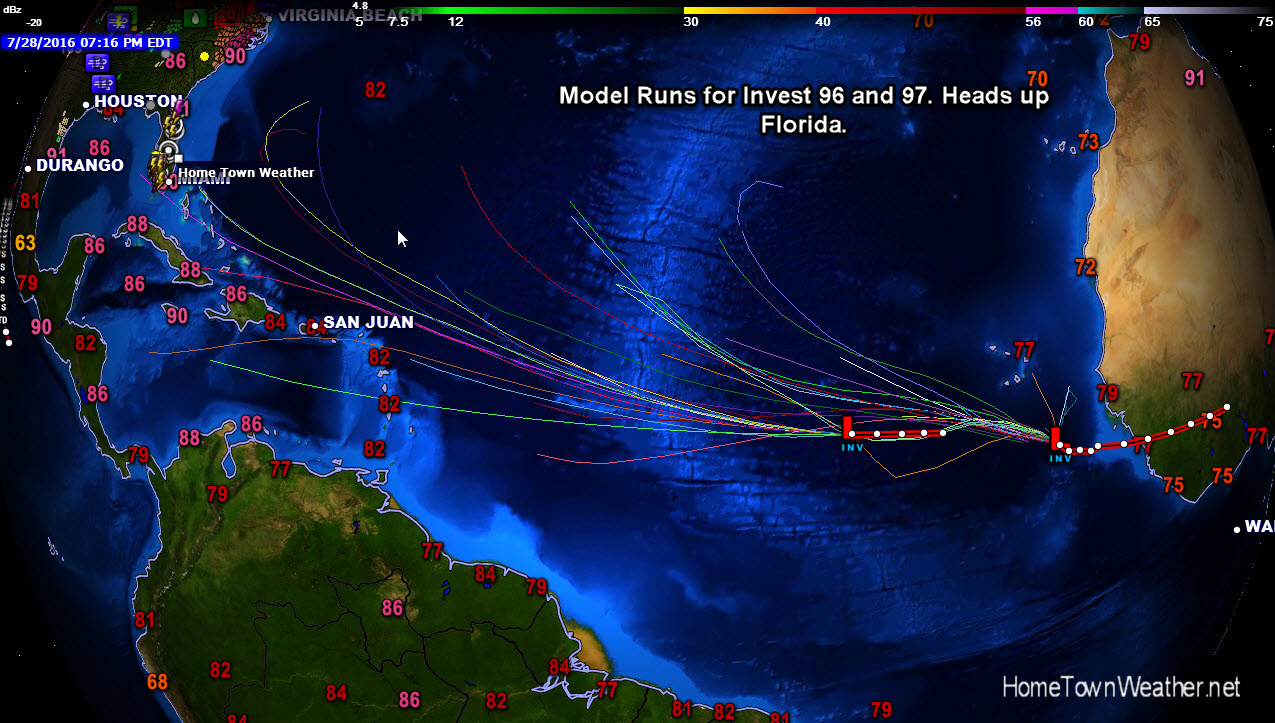
Now, talking about the two Invests that are out there today namely Invest 96L and Invest 97L. Both systems have just recently appeared and have a 40% and 30% chance of development. Current model runs are not doing much with either of the storms. Since there is lots of dry air still in the Basin, both will likely stay weak and not amount to a whole lot. As with any tropical system, they still have to be watched. I would expect the most critical time for Invest 97 is when it approaches the Leeward Islands around the weekend. Once it passes that region we will have to see if anything materializes. If necessary a Recon flight is planned for Invest 97 on Saturday. One factor that is in our favor is the speed that 97 is moving at. The fast forward speed will not allow any significant strengthening.
Because of the long lapse between hurricanes, many folks have forgotten what it is like to be without power for 2 weeks at a time or how hot it was to be without AC. Many did not even have city water. How about driving after a hurricane when there is no power or traffic lights. If you were one of the unlucky folks that lost their roof during the storms of 2004 and 2005, you might remember the inconvenience as it took months to get the repairs done because of material and labor shortages. You also should remember the sounds of the howling winds and the visions of flying objects passing just inches away from your windows. If your structure was protected by shutters, you probably just heard the sounds but did not see the flying debris.
In any tropical system, it is important to keep the wind from breaching any of your openings, including sliders and garage doors. Probably the two weakest points in your house are sliding glass doors and garage doors. The sliders should be protected with shutters and your garage door should be fitted with a special wind brace. In hurricane Andrew, it was found that the garage door was the single area that caused the most wind breaches that eventually led to roof failure.
With the season’s peak almost here, the time is NOW to get ready. Do not wait till a system is right on your door step.