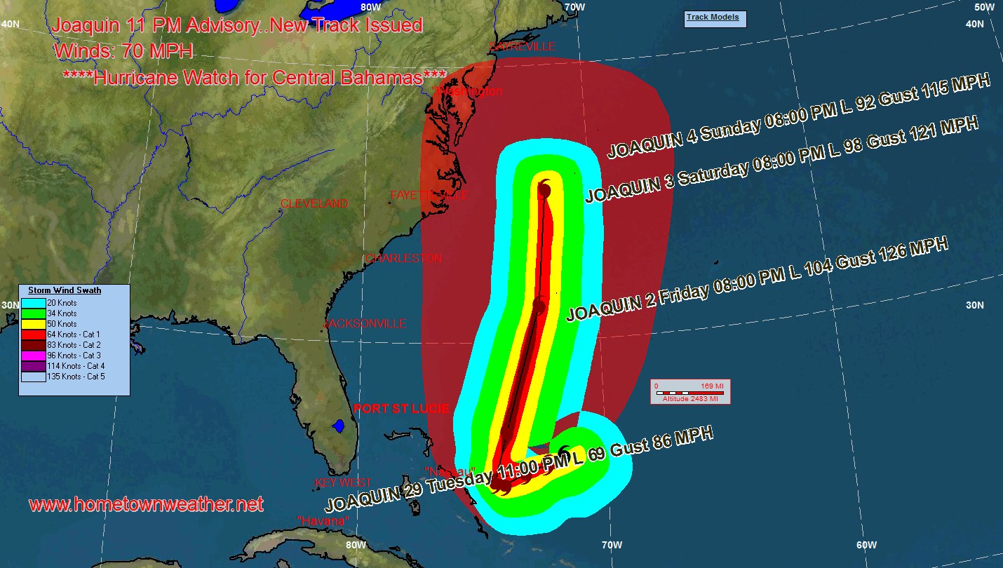
***Joaquin Becomes A Hurricane****
A Hurricane Warning is in effect for…
* Central Bahamas including Cat Island, the Exumas, Long Island,
Rum Cay, and San Salvador.
A Hurricane Watch is in effect for…
* Northwestern Bahamas including the Abacos, Berry Islands, Bimini,
Eleuthera, Grand Bahama Island, and New Providence, but excluding
Andros Island
Winds have increased to 75 MPH and the central pressure has dropped to 971 MB.