
Good afternoon everybody. We have a very interesting scenario unfolding as Joaquin continues to baffle the experts. The system is still moving West and at least one of the major models has it reaching the Bahamas before turning north. The shear that has been holding the system back is gradually going to weaken allowing intensification of the cyclone. Once past the Bahamas the models are mixed from a landfall near Virginia as a major storm all the way to a recurve out to sea. Until the system gets caught up in a steering current the models are going to be only a minimal guide.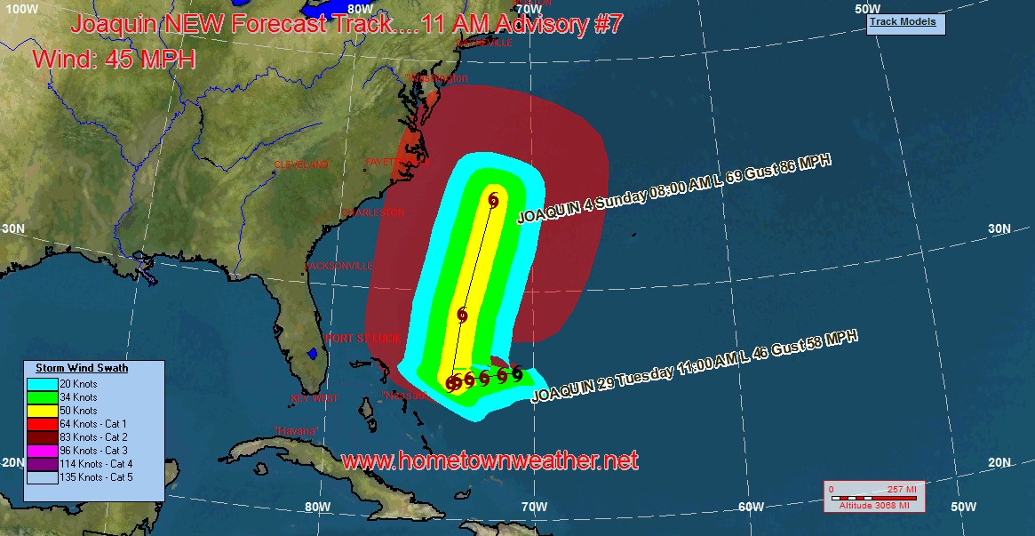
The track guidance is much slower then previously forecast with the system in the vicinity of the Mid Atlantic on Sunday rather then Friday. This track will likely change again as the system keeps moving towards the West. If that trend continues, we could see watches or warnings issued for the Bahamas.
The system is now forecast to be a 70 MPH cyclone out 120 hours.
The Mid Atlantic from Virginia to Canada should be paying close attention to the progress of Joaquin.
Tropical Models and Forecast Track:
http://www.joesdiscoweathercentral.com/Model1.html
Tropical Updates Fresh and Up To Date:
http://www.joesdiscoweathercentral.com/Tropical_Web_Forecas…
Atlantic Tropical Outlook and Storm Details:
http://www.joesdiscoweathercentral.com/Tropical_Outlook.html
Full Coverage from Hurricane Central:
http://www.joesdiscoweathercentral.com/Joe_s_Disco_Hurrican…