
Good evening everybody. AS of 11 PM**** Hurricane Watches have been issued for the Central Bahamas******
Maximum sustained winds are now 70 MPH and Joaquin is expected to be a hurricane tonight.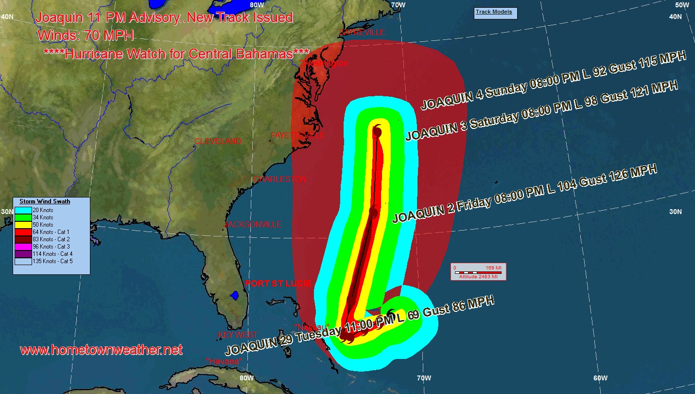
The cloud pattern of Joaquin continues to get better organized and the outflow is becoming much more pronounced. The cyclone is over very warm water and in an increasingly favorable environment. Many of the models are showing significant strengthening and the NHC forecast for intensity could be very conservative.
Joaquin is till moving to the south / southwest and this general motion is expected for the next 24 to 36 hours. A trough over the southeastern US should then turn Joaquin to the north. Most of the global models have shifted to the west and the official track has also been shifted but as far as some of the other models are showing.
Due to the complexity of the forecast, an exact track is not possible. If you live anywhere from the Carolinas north through New England, you need to be carefully watching the progress of this complex system. #Joaquin
Tropical Models and Forecast Track:
http://www.joesdiscoweathercentral.com/Model1.html
Tropical Updates Fresh and Up To Date:
http://www.joesdiscoweathercentral.com/Tropical_Web_Forecas…
Atlantic Tropical Outlook and Storm Details:
http://www.joesdiscoweathercentral.com/Tropical_Outlook.html
Full Coverage from Hurricane Central:
http://www.joesdiscoweathercentral.com/Joe_s_Disco_Hurrican…
.