**Winter Storm of Historic Proportions To Hit Mid Atlantic and New England on Monday night and Tuesday****
****DO NOT TRAVEL During this storm!!!!******
******Blizzard Conditions Possible!!!*****
A Winter storm watch has been issued for most of Massachusetts. A BLIZZARD Watch has been issued for Central Jersey including Middlesex county.
A major to historic storm is poised to hit the entire region. one to two feet of snow is possible in most locations. Locally heavier amounts are possible. Significant coastal flooding is possible as well.
The storm will be slow moving and of a long duration.Plenty of cold Canadian air will ensure that cold air will dominate.
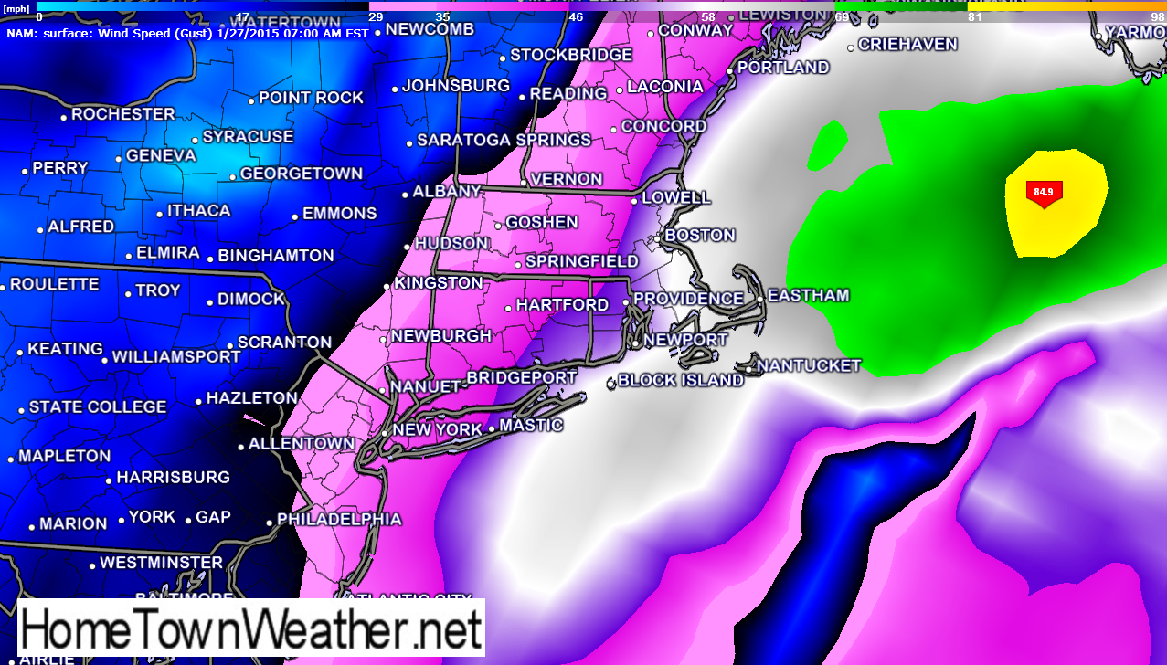
As I indicated in the model, winds with gusts to near 70 MPH are possible directly along the Massachusetts coast! Other wise, winds of 40 to 60 MPH will be common!
Travel will become impossible! Do not be a victim and stay off the roads during this historic event.
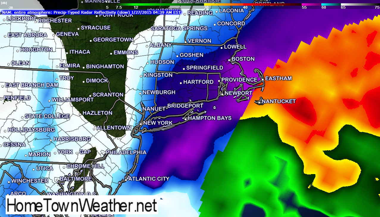
The following models indicate the latest wind speed model and the latest model (NAM) of the radar for Tuesday.
Massachusetts Radar and Forecast:
http://www.massachusettsradar.com/
New Jersey/New York Forecast and Radar:
http://www.joesdiscoweathercentral.com/New_York_and_Vicinity_Forecast.html