
Tropical storm Karen remains a sheared cyclone but is maintaining a very vigorous circulation. Most of the thunderstorm activity is to the north and east of the center. The intensity remains at 65 MPH with some slight strengthening possible before a weakening trend begins before landfall.
According to NOAA aircraft, Karen is moving to the North-Northwest at 9 knots.
Currently, a narrow ridge over Florida is keeping Karen away from the state. This ridge is expected to weaken and allow a more northerly component to Karen. Thereafter, Karen will begin to re curve to the north east.
SUMMARY OF WATCHES AND WARNINGS IN EFFECT…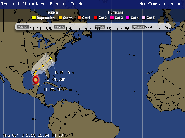
A HURRICANE WATCH IS IN EFFECT FOR…
* GRAND ISLE LOUISIANA TO WEST OF DESTIN FLORIDA
A TROPICAL STORM WARNING IS IN EFFECT FOR…
* GRAND ISLE LOUISIANA TO THE MOUTH OF THE PEARL RIVER
A TROPICAL STORM WATCH IS IN EFFECT FOR…
* WEST OF GRAND ISLE TO EAST OF MORGAN CITY LOUISIANA
* METROPOLITAN NEW ORLEANS
* LAKE MAUREPAS
* LAKE PONTCHARTRAIN
* DESTIN TO INDIAN PASS FLORIDA
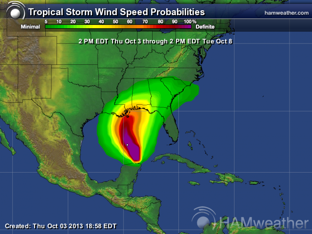
The good news is that we do not expect a real strong system. Rain and flooding will probably be the biggest issues.
It amazes me that this is the first system to threaten the US this season. The initial predictionss were so dire. The tropics have, thakfully, been extremly hostile to tropical activity this year. There have been lots of storms but they either stayed away from the US or they fell apart from either dry air intrusion or wind shear.