
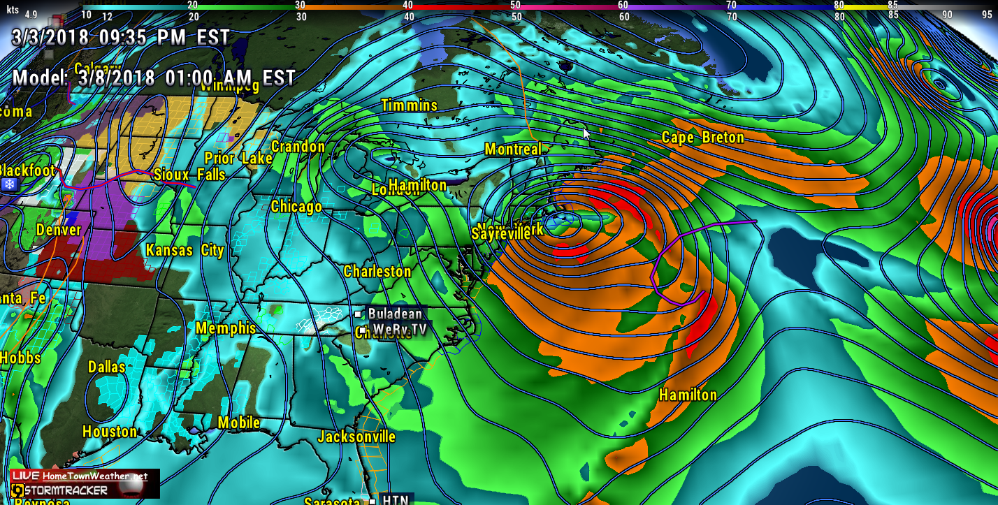
As if the latest super storm was not enough, yet another round of potential severe weather is possible about mid week in the north east. Models are again suggesting a developing low pressure area moving up the coast and creating a wind, coastal flood and snow event.
Although not near as bad, it will be affecting many of the same areas that were just hit hard by Riley. In many cases, recovery is only beginning.
Riley affected a good portion of the north east with relentless winds, rain,snow and storm surge. Winds clocked at over 90 MPH were reported in parts of Massachusetts.
The difference with this new system is that it could produce more snow while Riley was mostly rain. We will continue to monitor this system as it progresses but in the meantime, folks in the North East should again be getting prepared just in case.
The month of March is living up to its name by roaring in like a lion. The question is will it remain a lion the entire month.