
Good morning everybody. Joaquin continues to batter the Central Bahamas with category 4 winds of 130 mph. The cyclone is now undergoing an eyewall replacement cycle. The system is now finally beginning the turn and is moving towards the North West very slowly. The wind field has expanded and it is affecting areas all the way to Cuba and parts of the Dominican Republic.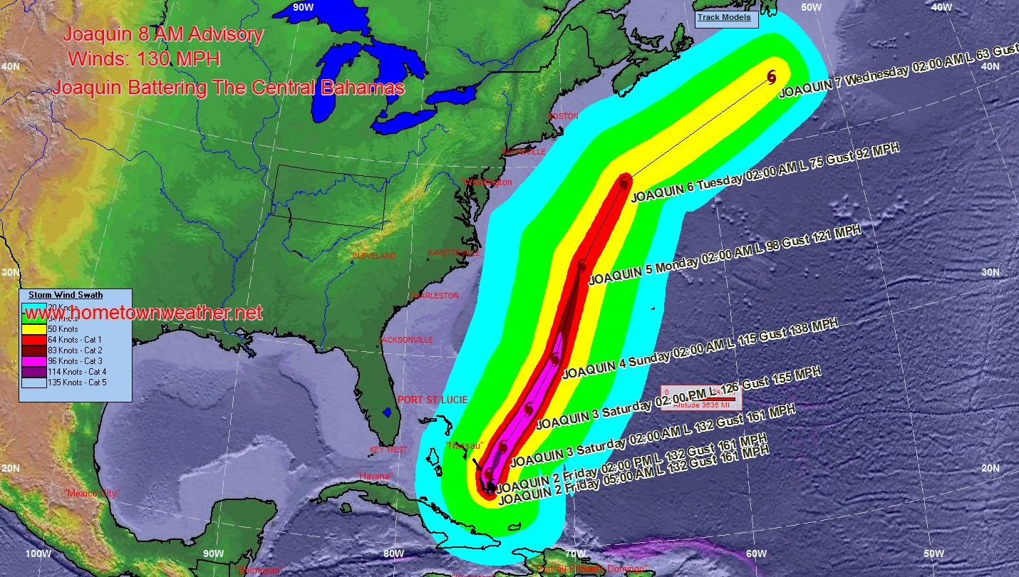
The forecast models continue to indicate a track offshore of the
United States east coast from the Carolinas to the mid-Atlantic
states, and the threat of direct impacts from Joaquin in those areas is decreasing. However, there is still uncertainty in how close Joaquin could come to Bermuda, extreme southeastern New England/Cape Cod, and Nova Scotia during the next several days, and interests in those areas should continue to monitor the progress of the hurricane. A Tropical Storm or Hurricane Watch could be required for Bermuda later today.
Even if the hurricane remains offshore, a frontal system will create a very heavy rain event along the East Coast. This rain is not directly associated with the hurricane.
Full Coverage from Hurricane Central:
http://www.joesdiscoweathercentral.com/Joe_s_Disco_Hurrican…
