Good evening everybody! If you live in the North East I am sure you have been seeing your fair share of snow and winter weather. The truth is that more is on the way in the form of a winter storm Sunday and Monday. The forecast amounts are going to change in the coming days but it looks as if it could be significant and plowable. (See graphic) This system will be nothing like the blizzard that just hit the region but some gusty winds are possible. Since this snow will be accumulating over snow that has already fallen, the totals on the ground will be quite high.
A lot of folks in New Jersey what happened to the forecast for the Blizzard of 2015. In short, the system tracked a bit farther east then was expected. A blocking scenario was in place and it was expected that the storm would hug closer to the coast. Since the Euro model is one of the most accurate and trusted models, and this is what most were looking at. The GFS had a different idea and it was the GFS that actually got the forecast. Predicting the exact track of one of these storms is still an imperfect science. Only a small deviation in the track can have a huge difference on the outcome. To caution on the side of error, local governments shut down all cities that were believed to be in the path of the storm. Had the storm hit as predicted and no precautions were taken, many folks could have been stranded on the roads or worse. It is always best to be safe instead of sorry when it comes to a monster storm.
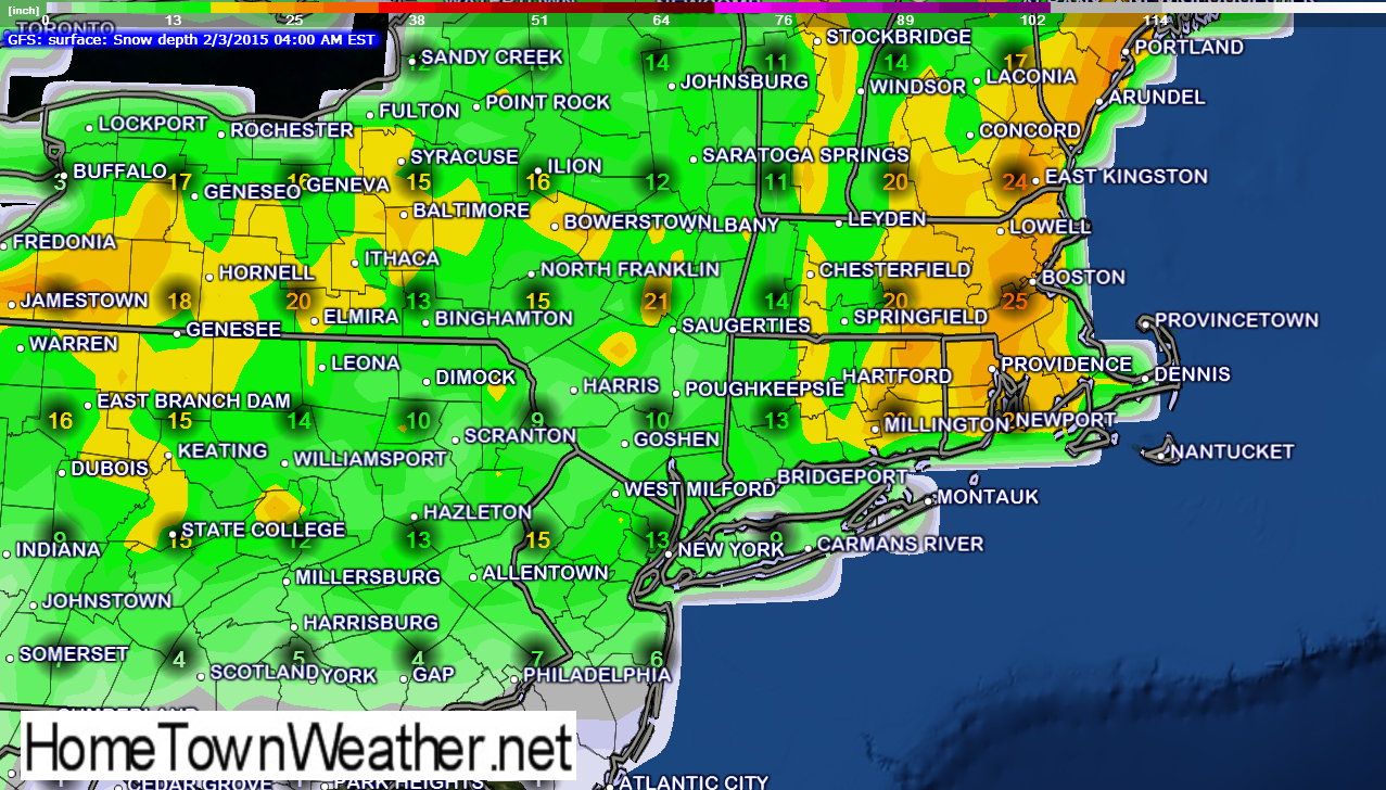
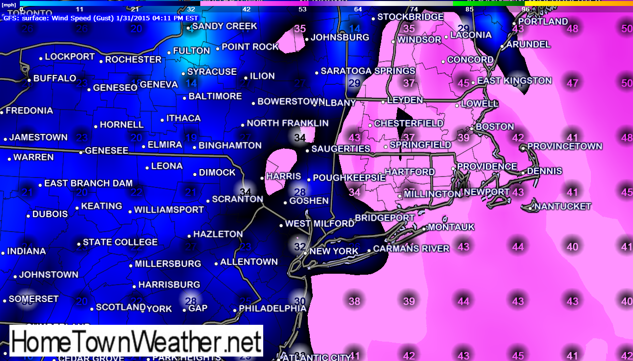
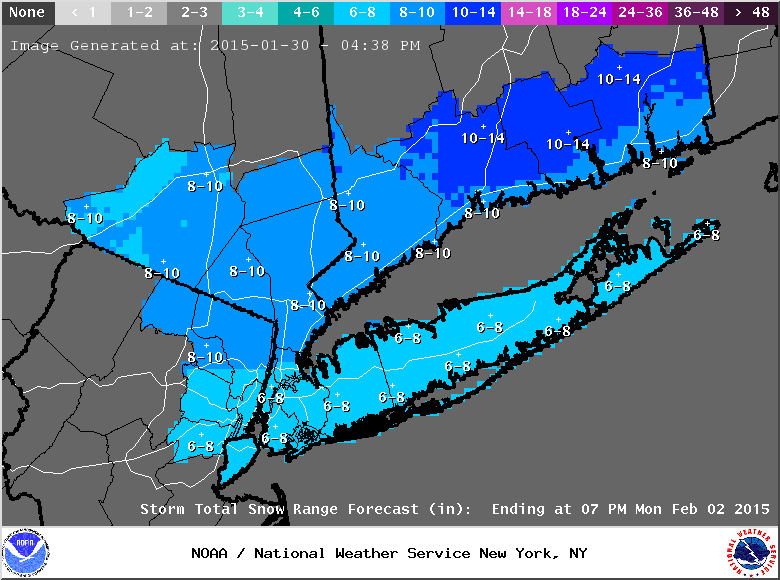
The first graphic is the GFS model of what the accumulative amount of snow that could be on the ground by Tuesday. This number includes the snow that already has fallen. The second graphic shows potential high wind gusts. Nothing like we saw in the previous storm. The third graphic from the NWS shows how much new snow has the potential to fall in the marked areas.
The forecast calls for an 80% chance of snow on Monday for Boston, 80% for Springfield, 50% for Portland Maine, 80% for New York City, 90% for Sayreville New Jersey and 90% for Atlantic City.
Winter Storm Watches are in effect for parts of New England.
Please share this valuable information and visit our websites for the latest forecast in your area.
New York/New Jersey forecast:
http://www.joesdiscoweathercentral.com/New_York_and_Vicinity_Forecast.html
Massachusetts Forecast and Radar:
http://www.massachusettsradar.com/