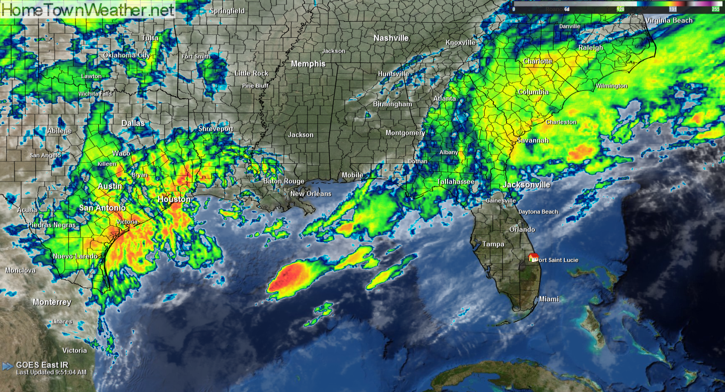
The cold front will linger across our region for most of the day today. The boundary will slowly move back to the north this evening and through the overnight hours. This will increase the precipitable water values through the day which may trigger some scattered showers today. There could be a rumble of thunder.
Developing low pressure in the Gulf will continue to gain organization and move into the Central Gulf of Mexico. This system will be associated with a trailing cold front. How much and how fast this system develops will make a big difference in the overall effects of this low in our area. The potential remains for a bout of severe weather with damaging straight line winds.
We will continue to monitor this system as it evolves and will update if any changes are seen or if any watches or warnings are issued.
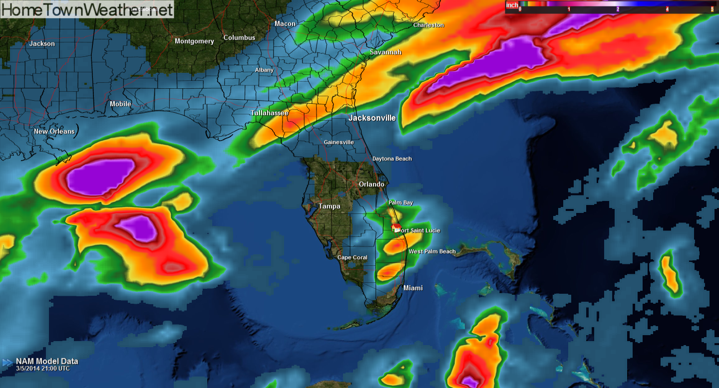
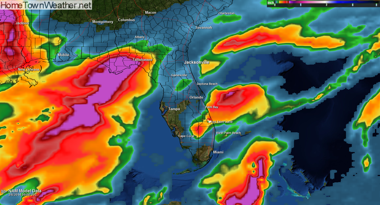
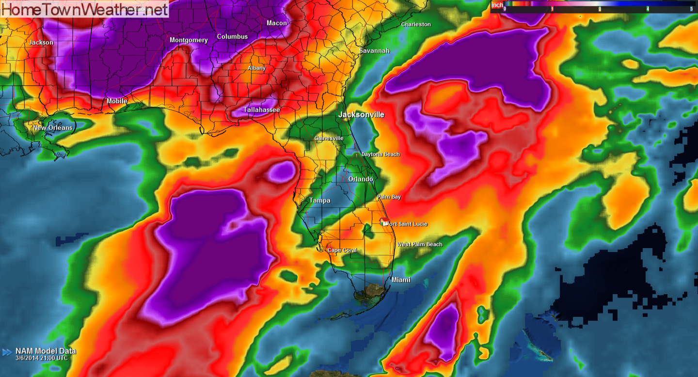
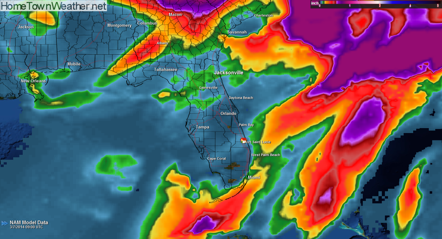
Below you will see images of the latest NAM model that I just ran. It shows the latest 12, 24, 36 and 48 hour runs. Note that in the 48 hour run, most of the precipitation is out of the area.
I am displaying two links below. The first is for the latest Florida radar (for all stations) and the second is our watch and warning graphic that displays the latest watches and warnings as they are issued.
#florida #treasurecoast
Florida HI Res Doppler Radar:
http://www.joesdiscoweathercentral.com/Florida_Doppler_radar_Loops.html
Florida watches and warnings:
http://www.joesdiscoweathercentral.com/Florida_Watches_and_Warnings.html