
A major winter storm is forecast to affect the North East from late Monday through Tuesday night. Blizzard watches have been issued for metro areas such as New York City and Boston as well as Long Island. Winter storm watches have been issued for almost all of the North East. 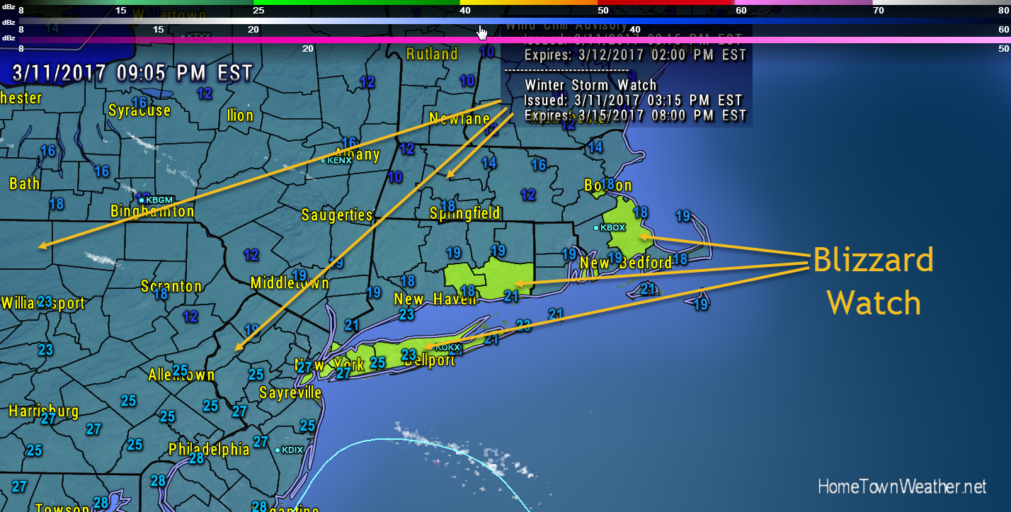
The National Weather Service in Upton has issued a Blizzard
Watch, which is in effect from late Monday night through Tuesday
evening.
* Locations…New York City, Long Island, Southern Westchester,
Southern Fairfield, Southern New Haven, Middlesex, and New
London counties.
* Hazard Types…Snow, and strong and gusty winds.
* Snow Accumulations…12 to 18 inches.
* Timing…Late Monday night through Tuesday evening.
* Impacts…Hazardous travel and potential for power outages due
to moderate to heavy snow and gusty winds.
* Winds…Northeast 20 to 30 mph with gusts 40 to 50 mph.
* Temperatures…In the upper 20s.
* Visibilities…One quarter mile or less at times.
The National Weather Service in Taunton has issued a Blizzard
Watch, which is in effect from late Monday night through late
Tuesday night.
* LOCATIONS…Southern Rhode Island and east coastal Massachusetts
from Boston to Plymouth.
* HAZARD TYPES…Heavy snow, strong winds, and reduced visibility.
* ACCUMULATIONS…Snow accumulation of greater than 6 inches
possible along drifting and blowing snow.
* TIMING…Tuesday and Tuesday night.
* IMPACTS…Rapid snow accumulation as well as blowing and
drifting snow may make many roads impassable. There could also
be scattered power outages.
* WINDS…Northeast 25 to 35 mph with gusts over 50 mph.
* TEMPERATURES…In the upper 20s.
* VISIBILITIES…One quarter mile or less at times.
Massachusetts Forecast and Radar