
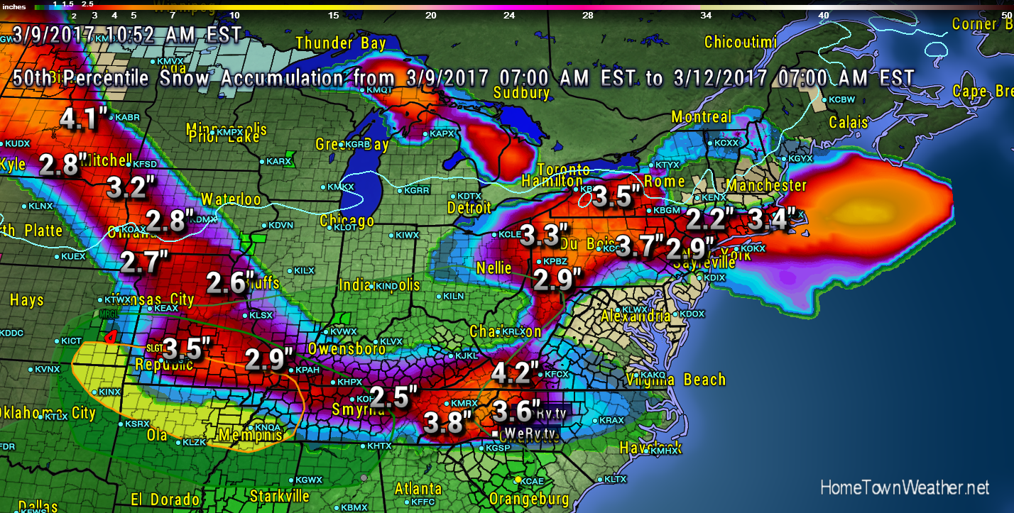
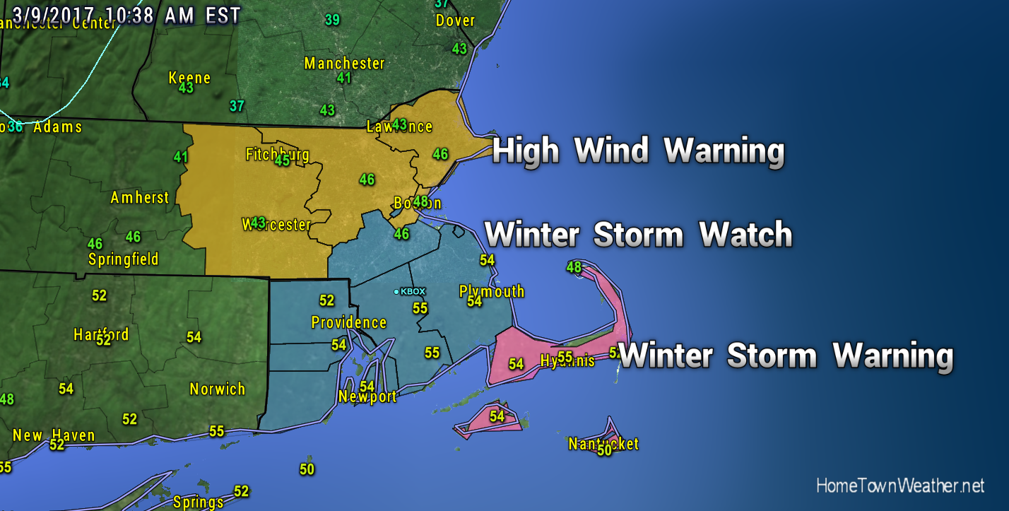
Good morning everybody. Snow will be the topic of the day as it threatens to hit both parts of the Mid Atlantic and Southern New England as well as parts of the South including a portion of North Carolina. A Winter Weather Watch is up for parts of Eastern New England.
…WINTER STORM WATCH IN EFFECT FROM LATE TONIGHT THROUGH FRIDAY
AFTERNOON…
The National Weather Service in Taunton has issued a Winter Storm
Watch, which is in effect from late tonight through Friday
afternoon.
* LOCATIONS…Rhode Island and Southeast Massachusetts.
* HAZARD TYPES…Snow.
* ACCUMULATIONS…Snow accumulation of 4 to 7 inches, heaviest
near the south coast.
* TIMING…Snow will develop after midnight, becoming heavy at
times toward daybreak into the morning. The snow will taper
off Friday afternoon.
* IMPACTS…Snow covered roads will make for hazardous driving
conditions. Snowfall rates may approach 1 inch per hour for a
time during the Friday morning commute.
* VISIBILITIES…One quarter to one half mile at times.
New York?New Jersey Forecast and Radar:
http://www.joesdiscoweathercentral.com/New_York_and_Vicinity_Forecast.html