
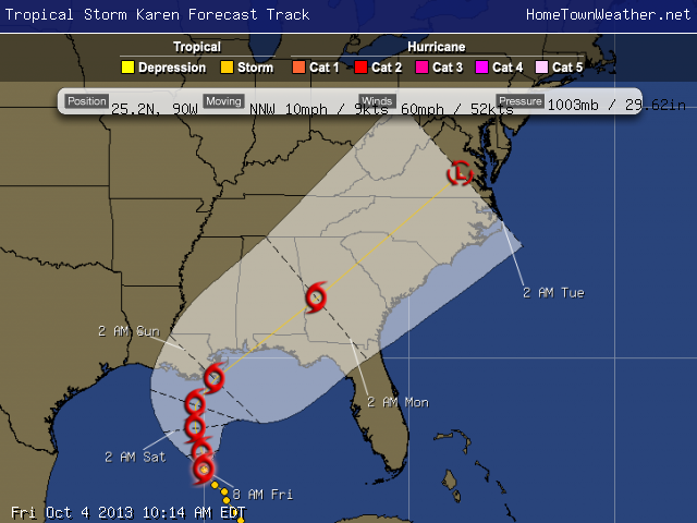
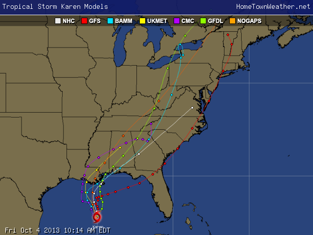
Some interesting changes in at least one of the models for Tropical Storm Karen this morning. The GFS is showing the cyclone taking a more Easterly track and hitting somewhere around Apalachee Bay and then stalling off the South Carolina Coast. We will have to watch carefully for any signs of this eastward trend as the day progresses.
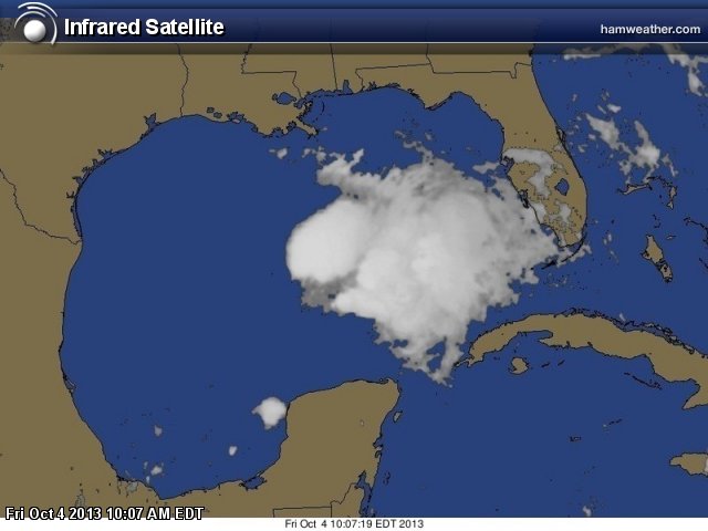
In general, Karen is actually a “mess” right now with the effects of the wind shear apparent. The main convection is well east of the center. The central pressure has risen from 999 mb to 1002 mb.
As mentioned before, the Euro has Karen making the North-East turn after landfall while the GFS has the system making the turn much sooner and making landfall on the North -Western Florida Peninsula. There is low confidence on the exact point of landfall. A system that tracks farther east could get stronger then one that is farther west because of the difference in wind shear.
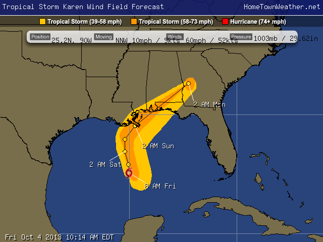
The intensity forecast is also going to be hard to determine because some of the conditions up stream may allow for some intensification before landfall. If Karen reacts with the upper level trough to her north, some convection bursts could occur that might add to the strength of the system.
With all the uncertainties, all residents in the Central and North Eastern Gulf need to be paying attention. There is low confidence in both the exact track and the intensity.
For the latest tropical updates, visit us at
http://www.joesdiscoweathercentral.com/Tropical_Web_Forecasts.html
Florida Radar:
http://www.joesdiscoweathercentral.com/Florida_Doppler_radar_Loops.html
Latest Tropical Models:
http://www.joesdiscoweathercentral.com/Model1.html
Visit our home page:
http://www.joesdiscoweathercentral.com/index.html
Everybody in the Gulf Coast region from the Central Gulf to North East Gulf needs to be paying attention. Remember, it does not take a full blown hurricane to cause all types of problems. Sometimes simple tropical storms can create all kinds of life threatening flooding situations. Be prepared for the worst and hope for the best whenever a storm is bearing down on your region.