
**Special Tropical Outlook****
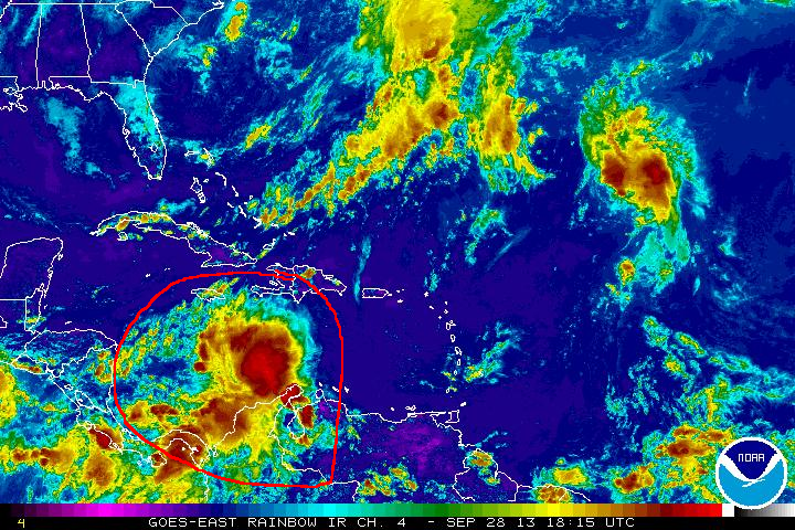
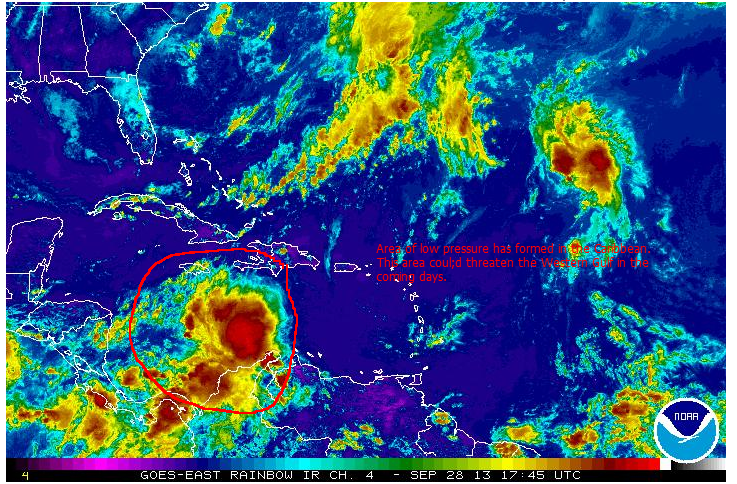
An area of low pressure has formed in the Caribbean and it has caught the attention of the NHC.
This area is in a location that could be conductive for development and is forecast by global models to enter the Gulf Of Mexico and be near the West Coast of Florida in about a week. As of now, the models are showing a weak tropical system but a lot can happen over the next few days as the area progresses.
None the less, folks along the Eastern Gulf should be watching the progress of this system. Nothing may come of this threat but on the other hand, this is a prime breeding ground for the month of October for tropical systems. There is plenty of undisturbed warm water in the Gulf for a cyclone to tap into right now.
While it is way too early to speculate on a Florida threat, we just want you to be aware of the potential.
For the latest tropical updates, visit us at
http://
Florida Radar:
http://
Latest Tropical Models:
http://
Visit our home page:
http://