***Tropical Outlook***
Tropical Storm Jerry is meandering aimlessly in the far Atlantic and will pose no threat to land.
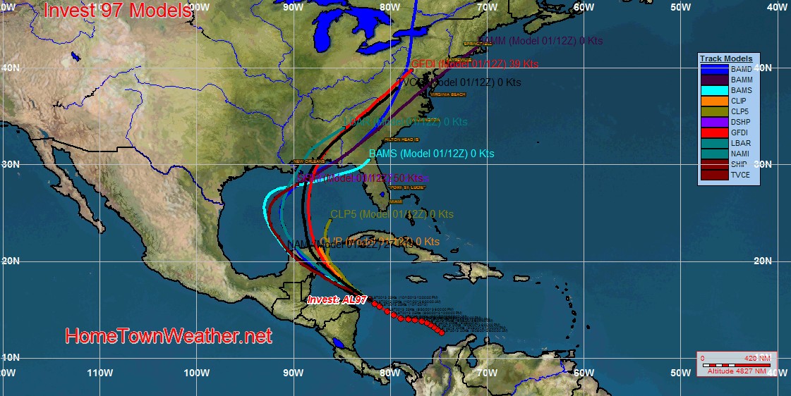
Closer to home, Invest 97 has jumped way up in the potential for development overnight. In addition, model runs have changed as well. Most of the models are showing a decent size storm hitting somewhere along the Gulf Coast from the Panhandle of Florida to near Louisiana. I just ran a simulated satellite model over the next week and it shows the system in the Gulf region around Friday or Saturday. Remember that once the system gets better organized, a better handle on the exact track will be evident.
For East Central Florida, it looks like the system will bring a better chance of rain for our region later in the week as the moisture that breaks away from the system moves towards Florida.
The government shutdown will not affect important weather related information that could affect life and property. Some of the NOAA sites have statements on the availability of information posted on them. All our systems at Home Town Weather are up to date and running normally.
For the latest tropical updates, visit us at
http://www.joesdiscoweathercentral.com/Tropical_Web_Forecasts.html
Florida Radar:
http://www.joesdiscoweathercentral.com/Florida_Doppler_radar_Loops.html
Latest Tropical Models:
http://www.joesdiscoweathercentral.com/Model1.html
Visit our home page:
http://www.joesdiscoweathercentral.com/index.html