
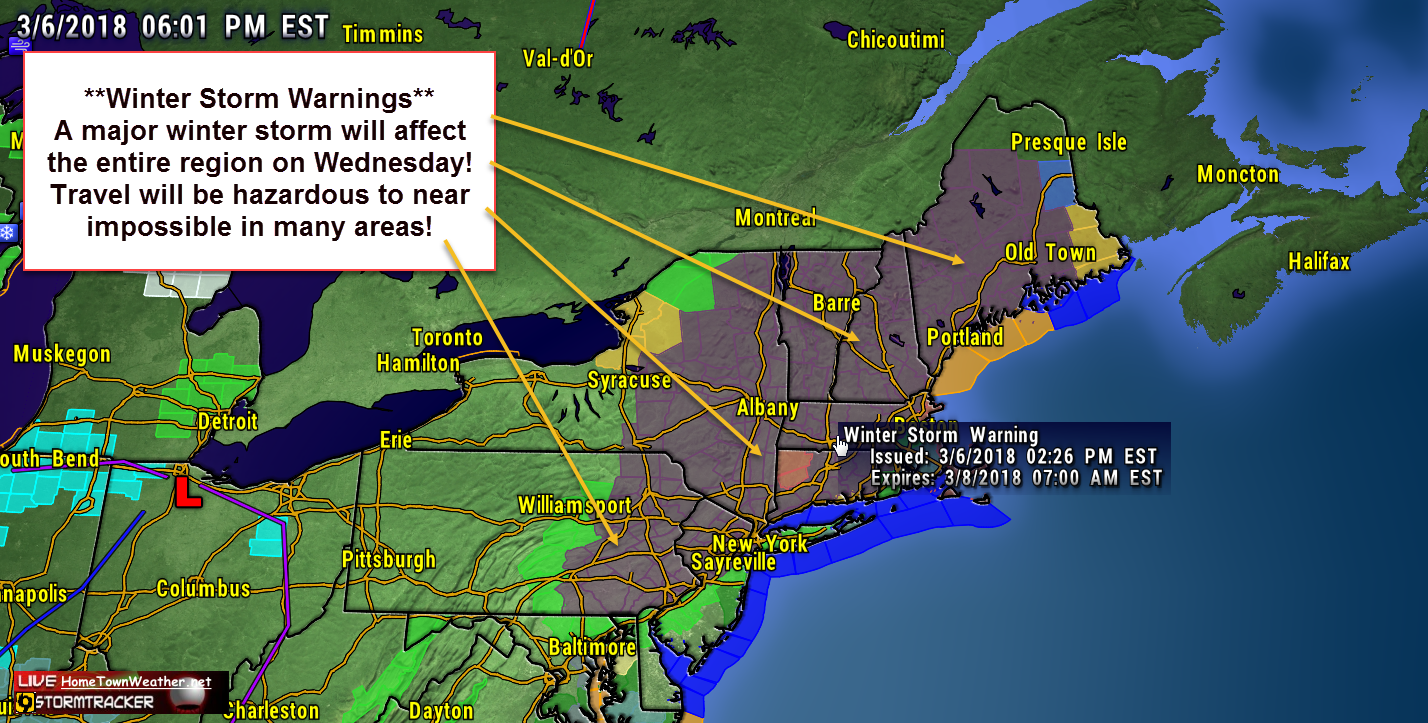
Another week, another Nor’Easter. It is starting to be a weekly routine in the Mid Atlantic and New England. A surface low will develop off the Delmarva Peninsula tonight and will drift northward as it develops. There is more confidence that the track will be closer to the coast and the result will be more precipitation, mostly in the form of snow. As a result, Winter Storm Warnings have been issued for a good part of the region.
Looking at the model runs, the models have renewed the confidence in the track that will bring heavy snow to the region. The snow have been up and down quite a bit but its a good bet that almost everybody will get more then 6 inches up to as much as 18 inches, especially in the hills.
The snow will start in the morning and then might taper off a bit and the start again with a vengeance. Currently, the governor of NJ has declared a state of emergency for the entire state.
Possibly one of the biggest issues aside from travel is the possibility of renewed power outages. Currently, there are still quite a few without power and the upcoming storm will put a damper on those efforts to get the power back on.