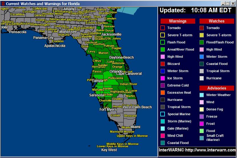
***Flood Watch Continues Through Tonight***
Hi everybody. We are still under a flood watch today through this evening. There is still lots of convection off the West Coast of Florida to move across our region. Some of the heaviest rain moving across right now appears that it will stay just north of Ft. Pierce as it slides across the state. Most of the heavy rain is expected later this afternoon into tonight.
Precipitable water soundings show a very moist atmosphere with water values at around 2.4 inches. This number should again lead to some excessive rain fall today.
It is possible the Flood Watch will again be extended tonight into tomorrow.
Looking at some long term models, all looks good for Florida tropical wise however, we are seeing a potentially disturbing scenario for the Mid Atlantic. Remember, this is not a forecast but rather a long term model run. We are seeing in at least 2 accurate models a storm developing off the Carolina coast and moving in to the Mid Atlantic as a potential Hybrid Storm. The same blocking mechanism that was there when Sandy hit last year is in place. That would mean a system going inland in a similar fashion to Sandy last year. We do not expect a storm as strong as Sandy but it is something these folks just need to be aware of in case this model scenario comes to play in about 7 days. We will have to see if the models keep playing this out or if just passes as a fluke.
Latest Watches and Warnings Map:
http://www.joesdiscoweathercentral.com/Florida_Watches_and_Warnings.html
Florida Radar:
http://www.joesdiscoweathercentral.com/Florida_Doppler_radar_Loops.html