
Archive for Uncategorized
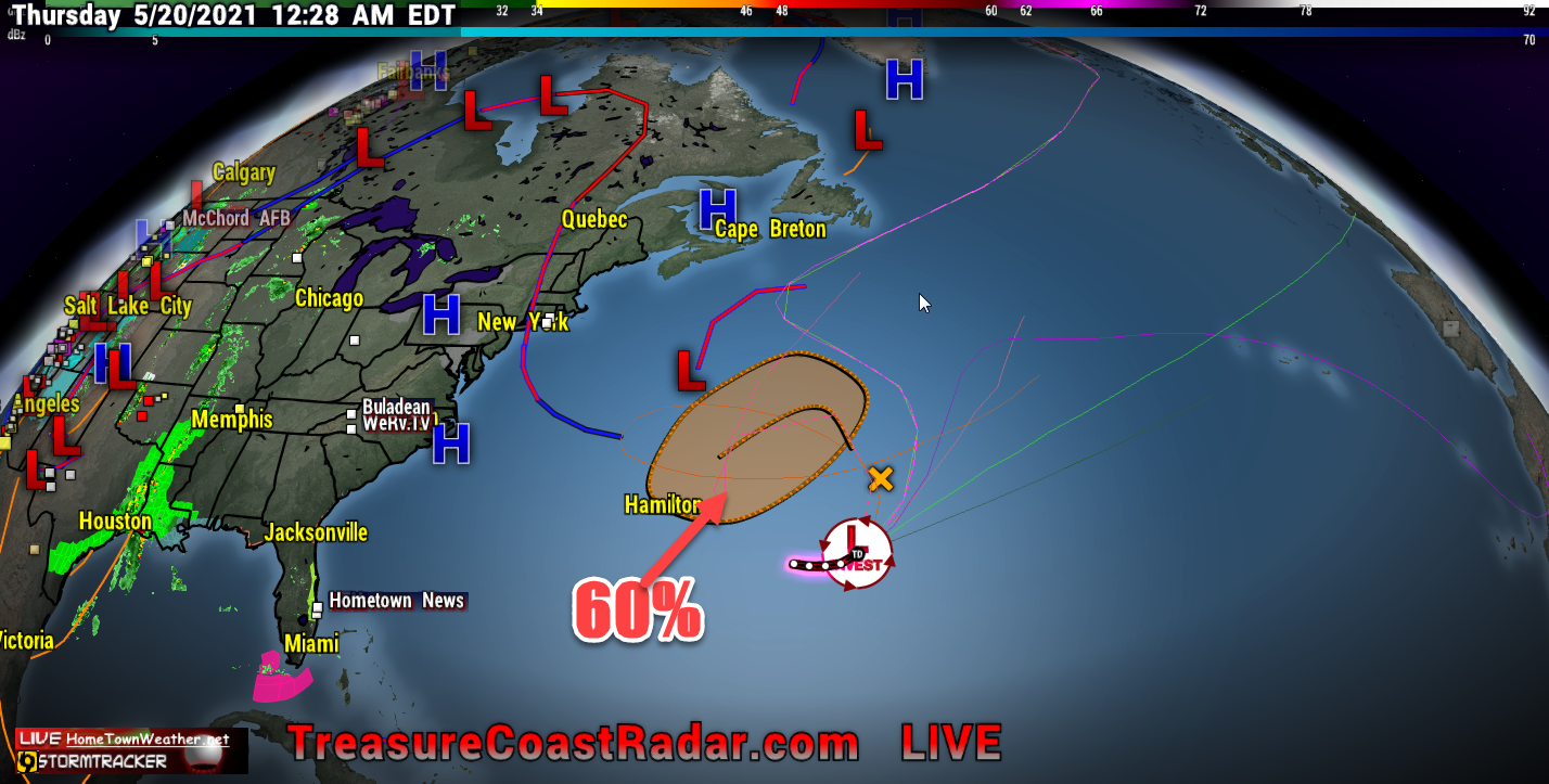
Invest Has 60% Chance Of Development
Even though this area has a 60% chance of formation, It will not affect the US. This is just a simple reminder that the season is almost upon us. We will be here for you without the HYPE and ANXIETY and just the facts as we have been for the past 24 years. Our website was one of the first third party websites in existence in the day. Today, most people either use apps or Facebook for getting their information. Our website is still there although a bit smaller, for those that still get their information on a computer. For fastest updates, Facebook is the way to go. We hope everybody fares well this Hurricane Season. Remember that preparation is key.
We do supply models out to about 7 days for those that like to view them. Remember that models are not forecasts and they can and likely will change. They are an important part of looking into the future. Models out past 7 days are quite useless and we rarely will show them.
We will hope and pray that the 2021 Hurricane Season spares as many as possible the extreme damage that we have seen over the years. Simply be prepared and ready for the worst and hope for the best.
Category: Uncategorized |
Watching Two Areas In The Atlantic
7/30/19 Tuesday- Today we are watching 2 areas in the Atlantic. Invest 95L in the Caribbean and an area of disturbed weather in the Eastern Atlantic. Right now Invest 95L has a 10% (low) chance of development. Regardless of development, it will mainly be an increase in rain chances for Florida and possibly also along the East Coast. Wind shear, dust and interaction with land will keep this system from developing in the short term. If any development does occur it will likely be weak and not until it is East of Florida or the Carolina’s.
Category: Tropic Watch 2019, Uncategorized |
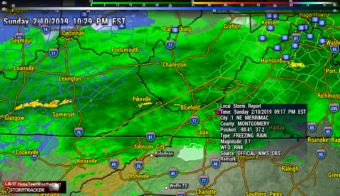
Freezing Rain Reported Merrimac, Virginia
…Winter Weather Advisories in effect tonight…
A mixture of rain, freezing rain, and sleet will continue across
the area tonight. Ice accumulations up to a tenth of an inch is
possible in the coldest locations. Icy roads have been reported on
Potts Mountain along Route 311. Drivers should prepare for
slippery icy roadways and use extra caution while driving
tonight. Freezing Rain.
Category: Uncategorized |
Hurricane Florence, My Final Thoughts
I have been a storm spotter/tracker since 1997 and I have seen, experienced and tracked some of the worst scenarios known to man. Hurricanes are by far the most destructive storms on the face of the planet. I have had personal experiences with more hurricanes then I care to remember. As destructive as they are, hurricanes are an important part of our eco-system. They are necessary to balance out the heat from the deep tropics and transfer some of that heat to the northern latitudes. Without this heat equalization, our climate could suffer even bigger consequences. Normally, hurricanes want to recurve out to sea, The rotation tries its best but sometimes big bubbles of air (High Pressure) get in the way and totally disrupt this process. That was the case with Florence. The position that Florence was located in the ocean has never in History produced a storm that made landfall. Most storms that affect the Carolinas come in more from a southerly angle through the Bahamas or just East of the Bahamas. The angle of approach for Florence was unprecedented.
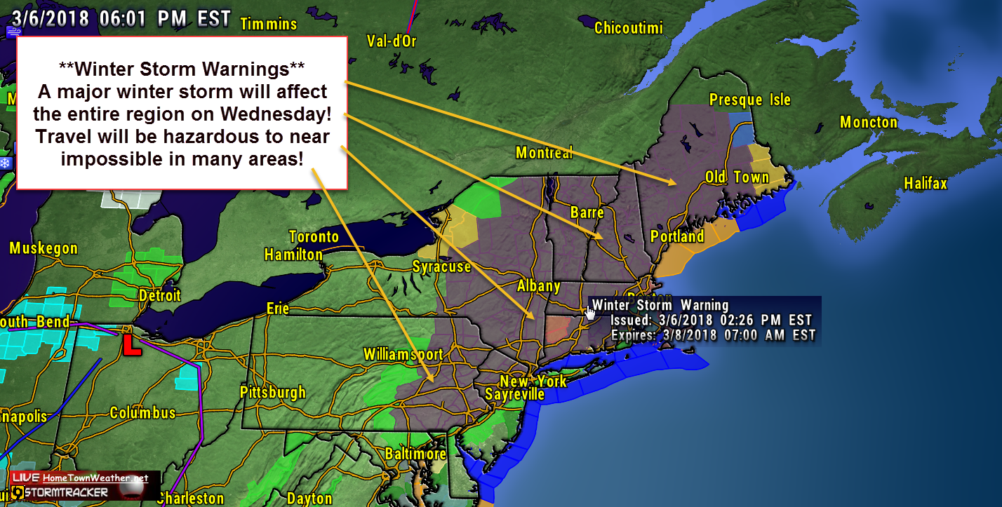
Major Nor’ Easter Headed For North East
Another week, another Nor’Easter. It is starting to be a weekly routine in the Mid Atlantic and New England. A surface low will develop off the Delmarva Peninsula tonight and will drift northward as it develops. There is more confidence that the track will be closer to the coast and the result will be more precipitation, mostly in the form of snow. As a result, Winter Storm Warnings have been issued for a good part of the region.
Florida Weather Looks Great For Christmas Day
I just ran thwe NAM radar model for Christmas Eve and things look quiet for the Treasure Coast. Areas to our north around Georgia and North Florida looks like rain could be the rule. The air 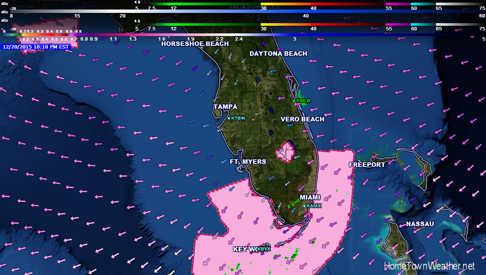 flow in Florida has now shifted to an onshore breeze and with that comes a moister air flow with an increased chance of showers the next couple of days. By Christmas, this flow will turn more from the south and long with the very warm temperatures, we will be looking at low rain chances in the 10% range as is being replicated in the NAM model.
Category: Uncategorized |
Bertha Nearing South East Bahamas
***Morning Bertha Update***
Tropical Storm Bertha is now moving near the Southeastern Bahamas. The Tropical Storm watches for the Central Bahamas has been dropped.
The cloud pattern of Bertha has gotten better organized overnight. banding features are starting to finally materialize as the system moves into an area of lower shear and high water temperatures.
NOAA Aircraft confirms that the low-level circulation is getting better defined.
The cyclone will continue to move around the edge of the ridge and move north and then north-east out to sea.
Hurricane Season 2014 Has Begun
Hi all and welcome to Hurricane Season 2014. The forecast for this year is projected to be an average to slightly below average season for the Atlantic. This forecast is due to a phenomena known as El Nino. El Nino is a warming of the tropical Pacific that affects the weather across the globe. Normally this scenario will help to suppress the formation of storms by creating strong trade winds that blow across the Atlantic.
Category: Uncategorized |
Our Website and Java…Site Is Now Converted To Flash!
Update….All our radars have now been converted to Flash as of 2/26/14!
Like many websites, our website uses the Java platform for some of our messaging features and radar loops. To make the program more secure, Oracle has added security measures that make it harder to run anything that is Java based. Our site uses known safe and trusted scripts that are only used when absolutely necessary to get the weather information to you. Our primary use of Java is with our unique radar loops. Our loops are unique in the fact that they contain lots of information that can be useful for not only a homeowner or business but also to storm trackers. These loops currently can only be displayed with Java.