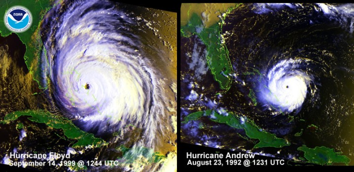
Hurricane Floyd 1999

 Floyd was first detected as a
tropical wave that moved off the African coast on September 2. The system
developed into a tropical depression over the tropical Atlantic on September 7.
Moving steadily west-northwestward, the system became a tropical storm the next
day and a hurricane on the 10th. A northwestward turn late on the 10th was
followed by a westward turn on the 12th, with the second turn marking the time
Floyd started strengthening in earnest. It became a Category 4 hurricane on
September 13 as it approached the central Bahama Islands. A west-northwestward
turn late on the 13th took the center through the northeastern Bahamas. This
was followed by a gradual turn to the north-northeast, which brought the center
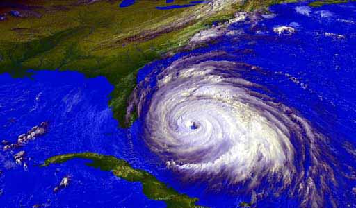
to the North Carolina coast near Cape Fear on September 16 as a Category 2
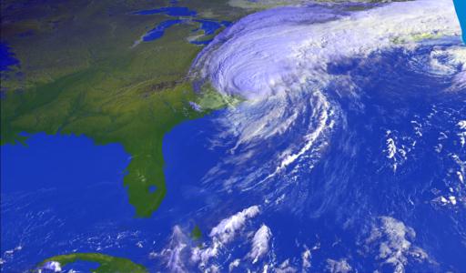
hurricane. Floyd continued north-northeastward along the coast of the
Mid-Atlantic into New England, where the storm became extratropical on the
17th. The remnants of Floyd merged with a large non-tropical low on September
19.
Floyd was first detected as a
tropical wave that moved off the African coast on September 2. The system
developed into a tropical depression over the tropical Atlantic on September 7.
Moving steadily west-northwestward, the system became a tropical storm the next
day and a hurricane on the 10th. A northwestward turn late on the 10th was
followed by a westward turn on the 12th, with the second turn marking the time
Floyd started strengthening in earnest. It became a Category 4 hurricane on
September 13 as it approached the central Bahama Islands. A west-northwestward
turn late on the 13th took the center through the northeastern Bahamas. This
was followed by a gradual turn to the north-northeast, which brought the center
to the North Carolina coast near Cape Fear on September 16 as a Category 2
hurricane. Floyd continued north-northeastward along the coast of the
Mid-Atlantic into New England, where the storm became extratropical on the
17th. The remnants of Floyd merged with a large non-tropical low on September
19.
While wind gusts of 120
mph and storm surges of 9 to 10 ft were reported from the North Carolina coast,
Floyd will be most remembered in the United States for its rainfall. The
combination of Floyd and a frontal system over the eastern United States
produced widespread rainfalls in excess of 10 inches from North Carolina
northeastward, with amounts as high as 19.06 inches in Wilmington, North
Carolina and 13.70 inches at Brewster, New York. These rains, aided by rains
from Tropical Storm Dennis two weeks earlier, caused widespread severe flooding
that caused the majority of the $3 to 6 billion in damage caused by Floyd.
These floods also were responsible for 50 of the 56 deaths caused by Floyd in
the United States. Floyd also caused damage in the Bahamas, with one death
reported.


